
Follow an Attleboro Street Directory Search
Begin with one confirmed street number, not a surname alone. Attleboro’s parcel map links an address to a parcel and current assessment data. That gives the next search a stable identifier even when a tax mailing address is elsewhere. From there, compare the owner shown on the card with the Northern Bristol deed index, then use a local voter-record request or an address-oriented historical source only for the separate question of who may have occupied the address. Each source answers a narrower question than a full address history.
- Enter the address, street root, or parcel ID in AxisGIS. Select the matching parcel and copy its parcel ID, situs address, owner, and any linked deed or plan reference.
- Search the same street root to review the returned addresses. Use the map and report controls to keep the segment separate from similarly named streets.
- Check the Northern Bristol Registry’s street or recorded-land tools. If an address does not return a useful result, search the current owner as a grantee instead.
- For a current registered-voter question, request the appropriate municipal voter list. The statewide status form requires one person’s name, birth date, and residential ZIP, so it cannot browse a street.
- For a past address, compare the parcel and deed trail with a State Library house guide, historical directory, map, newspaper, or census record from the relevant period.
Keep the street spelling, suffix, parcel ID, book and page, and search date together. Attleboro and historical sources can use spelling or street-name variations, while a legal description and plan reference often carry a land trail across those changes.
Search Attleboro Streets in AxisGIS
The Attleboro AxisGIS viewer accepts an owner name, address, or parcel ID. Its help material recommends using less text when a search is uncertain. For a street search, enter the street root without “Street” or “St,” then read the matching results before selecting a parcel. That small choice matters because assessor data reflects human entry and suffix variants can split otherwise related results.
The Attleboro Assessors Office maintains the ownership information that follows recorded Registry transactions and maintains the city’s tax maps and GIS.
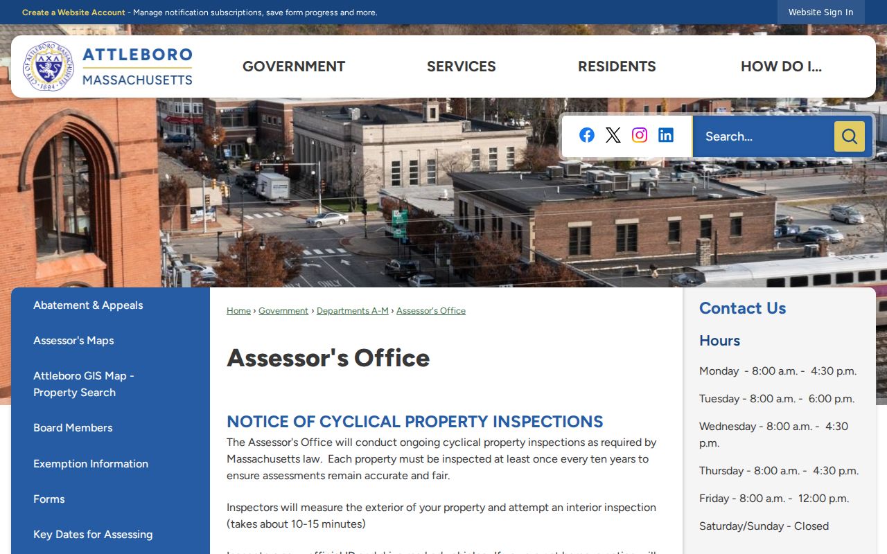
Use the assessor route for the current parcel, then retain the exact address returned by the viewer. It is the starting point for a street-by-street check, not a complete roster of everyone at the address.
After choosing a result, the map zooms to the parcel. The viewer can report selected or matching parcels, change a selection with Add or Remove, and zoom to the selection. Layers may add zoning, flood plain, wetlands, district, and other map context where available. Those layers help distinguish the land record from a name-based search result.
Attleboro Address Search Fields
AxisGIS does not require a special street-directory form. The standard search box supplies the fields that make an address search practical. Autocomplete returns possible matches beneath the box, and selecting one opens the map and parcel details.
| AxisGIS field or control | Entry method | Street-search use |
|---|---|---|
| Search text | Autocomplete or free text | Begin an owner, address, or parcel-ID search. |
| Owner | Last name first; first name may follow a space | Compare the current taxable owner with a Registry party. |
| Address | Street root before suffix | Return matching addresses and review the street segment. |
| Parcel ID | Exact local format; zero padding may matter | Preserve a stable identifier for reports and deed research. |
| Report and Zoom | Selected or matching parcels | Review a chosen group without treating it as a resident list. |
| Assessment and Documents & Links | Parcel-detail tabs | Separate assessment data from linked property cards, permits, plans, and pages. |
“Assessment” and “Documents & Links” are distinct tabs. The first is the assessor-side information; the second can link to a property card, permits, plans, and web pages when available. The exact labels and values on an individual Attleboro card were not captured in the research, so read the live card rather than assuming every parcel has every field.
Read an Attleboro Parcel Card
A street directory search becomes more reliable when the parcel terms are kept straight. The owner and the location of the parcel may point in different directions. AxisGIS can show a selected boundary, map location, owner information, an assessment tab, document links, and map layers, but the viewer’s visible details are still assessment-linked data rather than a promise of occupancy.
- Parcel
- A defined piece of taxable land shown by a boundary and identifier in the assessor system.
- Situs address
- The physical address of the parcel. It identifies the land on the street and is the useful starting point for a map or deed search.
- Mailing address
- The address used for the tax bill or owner correspondence. It can be outside Attleboro and is not proof that the owner lives at the parcel.
- Plan
- A recorded drawing that can identify lots, boundaries, and a plan book or page. It can bridge an older deed when a street address changes.
- Criss-cross directory
- An address-oriented directory or house guide that may lead from a street number to a historical occupant or householder.
The Planning and Development page links the city’s map resources and describes using AxisGIS to locate parcels by address, parcel ID, or owner and to review assessing, zoning, flood-plain, wetland, and other map information.
Map context can explain why a result belongs to a particular parcel, yet it does not establish the current occupants of a structure. Check the tax-card address, deed legal description, and date of the record before drawing a conclusion.
Attleboro Records Searchable by Street
Several Attleboro record sets begin with an address, but their coverage is different. The assessor and GIS are the current parcel layer. The Registry records land transactions. Voter material is a regulated list of registered voters, not a street-browse function in the state portal. Permit and board files can supply dates and names, although no citywide online permit index was found in the official material inspected.
| Address record | Attleboro keeper or route | What it can establish | Access path |
|---|---|---|---|
| AxisGIS parcel and assessor record | Attleboro Assessing | Parcel boundary, owner, situs and mailing addresses, assessment data, linked documents | Free AxisGIS viewer |
| GIS layers | AxisGIS / city map resources | Zoning, flood, wetland, district, and map context where enabled | Viewer layers and legend |
| Recorded deeds and plans | Northern Bristol Registry of Deeds | Recorded parties, legal descriptions, plan references, book and page trail | Portal, Taunton counter, phone, or email |
| Municipal voter list | Local election official | Permitted public voter fields for listed addresses | Request locally; protected and minor records are withheld |
| Permit, code, or board file | City department or City Clerk | Project, applicant or owner, dates, inspections, and address evidence when held | Address-and-date request; no indexed citywide database located |
| House guide or reverse directory | Massachusetts State Library | Historic address to occupant or householder lead | Library holdings and research route |
| Sanborn or historic map | Library of Congress and map collections | Building footprint, use, lot setting, and map-era street evidence | Online map images and local research |
The parcel ID, legal description, and plan reference tie the property material to the deed trail. A street name helps locate GIS results, voter records, permits, and historical material, but it can be less stable than the legal land description. A statewide MassGIS parcel layer is another public map resource; record its fiscal-year metadata and update context when comparing it with municipal data.
MassGIS receives municipal parcel submissions and publishes after quality review, so it can be useful for map context without replacing the live Attleboro assessor record for a current question.
Note: Use the street name to find a lead, then use the parcel and legal description to verify that records describe the same land.
Follow Attleboro Deeds Along a Street
Attleboro lies in the Northern Bristol Registry district. The Northern Bristol Registry portal offers Recorded Land Inquiry, Recorded Land Street, Land Court Inquiry, plan searches, Advanced Search, and Image Search. Registration is free, while the portal says document printing costs $1 per page. Its online documents are informational; obtain an official copy from the Registry when one is needed.
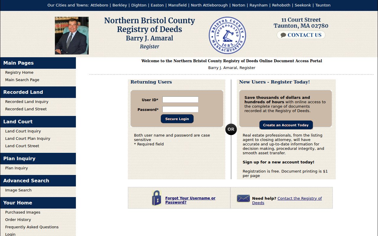
The Registry gives its main office as Northern Bristol County Registry of Deeds, 11 Court Street, Taunton. The research did not locate a published earliest year for the online index, so do not assign an online coverage date without confirmation from the Registry.
Use the deed chain as a land trail. Find the current owner’s acquisition document, identify the seller, then search that seller as a grantee before the later recording date. Record the book and page, document number, recording date, legal description, plan reference, and any image link. If an address search fails, the legal description, lot, plan, prior street name, and neighboring owner can provide a better bridge.
- Confirm the current street number and parcel ID in AxisGIS.
- Copy the owner, legal description, and any linked book, page, or plan reference from the parcel details.
- Run a town-and-street or recorded-land inquiry at the Registry, then inspect the current acquisition document.
- Search the seller as the earlier grantee, using alternate spellings, trustees, estates, or corporate names when the document indicates them.
- Repeat backward and contact the Registry about older books or microfilm when the online path ends.
Use Attleboro Registry Image Fields
The Registry’s advanced image search is useful when a deed, plan, or Land Court reference is already known. The inspected controls include Book and Page for recorded land, Start and End date fields, Town, Doc Type, Plan book and page, Land Court document number, and certificate number.
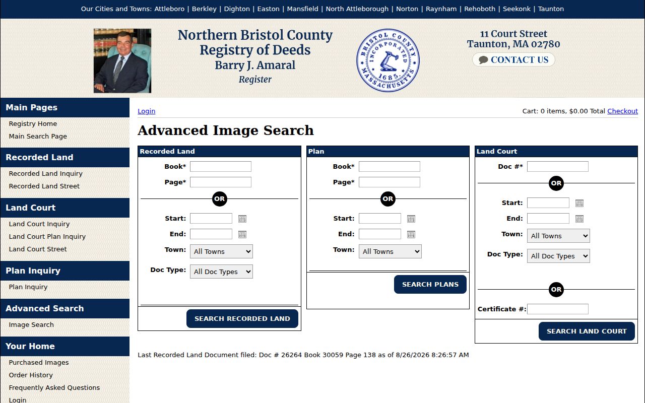
Choose Attleboro in the Town control and use the document clues from the parcel or prior Registry result. The live last-recorded notice indicates current data, but it does not answer how far back the online index reaches. The research also did not expose party-role labels or all document fields in a successful live result, so rely on the actual result and the Registry for official-copy questions.
Attleboro Voter Records by Street
Massachusetts separates an individual registration check from a local voter-list request. The Secretary of the Commonwealth’s voter-status form requires first name, last name, month, day, year of birth, the five-digit residential ZIP, and an acknowledgement. It reports a submitted person’s registration or pre-registration status, active or inactive status, polling place, and elected officials. It is not a public street-by-street browse.
A public local voter list can include name, address, party, date of birth, active or inactive status, and voter ID number. Additional material available by request may include election participation, prior record changes, mailing address, registration date, and inactivity date. Ballot choices are not released. Phone and email data, permanent absentee status, confidential-voter records, and records involving minors can be withheld. The statewide voter file is not a general public record, and the exact Attleboro request form and local fee were not located in the research.
Address a municipal request to the proper local election custodian with a defined street segment or date and a request for existing records. A returned voter address is evidence about a registered voter, not proof of every person who stays at that parcel. Protected voters must not be identified or inferred from an absence in a list.
Attleboro House-Guide Address Layer
The Massachusetts State Library holds an unusually useful address-focused layer for this work: Attleboro house guides for 1925–26, 1927–28, 1929–30, 1931–32, 1933, 1935, 1936–37, 1938, and 1941–42. Those runs are distinct from alphabetical city directories. They can turn a street number into a historical occupant or householder lead, subject to the edition’s abbreviations and coverage.
The State Library also lists Attleboro directories from 1877–1895, 1897, 1899, 1901, 1903, 1905, 1907, 1909, 1911, 1913, 1915, 1917–1933, 1935–1942, 1944, and selected later years through 1990. Consult the State Library holdings list for the actual shelf runs rather than filling in missing years. Read a name entry and the street or house-guide entry together, because the printed key may distinguish a householder, a business occupant, or another listed role.
This address layer is a strong historical supplement to a deed search. It is not a substitute for a current property record, and it should not be used to guess a present household.
Note: Preserve the directory year and page with any address result, because the documented Attleboro runs include real gaps.
Attleboro Street Geography and Names
Address research crosses more than one geography. Attleboro is a city in the Northern Bristol Registry district, while postal South Attleboro is an accepted neighborhood or postal name rather than a separate municipality. City boundaries, postal labels, precincts, parcel situs, and Registry jurisdiction do not always answer the same question. Use the parcel boundary and legal description for land, USPS for mail, and the election office for precinct issues.
No official source inspected documented an Attleboro-wide historical renumbering year or a complete renamed-street list. Historical maps can still help bridge an older place name or village label, but they do not authorize an assumed conversion to a current number. The Library of Congress holds Attleboro material including an 1850 Walling map, 1891 bird’s-eye maps, and Sanborn editions. When an old address will not connect, compare the map-era street name, legal description, house guide, and adjoining owners.
Limits of Attleboro Address Searches
Property data identifies taxable ownership and a mailing address, not everyone who lives at a parcel. Historical directories and house guides can identify past occupants or householders only for their own printed years. Utility customers, delivery addresses, and personal motor-vehicle addresses are not public resident lists. The federal Driver’s Privacy Protection Act restricts personal DMV data. A mailed tax address also cannot prove residence at the situs address.
When an address-based source is missing online, make a specific request to the custodian instead of trying to fill the gap with assumptions. The Massachusetts public-records guidance supports written requests that describe the existing record, date range, and desired electronic format. Under Massachusetts Public Records Law, M.G.L. c. 66, § 10, a records access officer generally responds within ten business days; the office need not create a new record or answer a research question.
For local address files, the City Clerk is the practical starting contact for records access and can route or identify municipal material. Ask for an existing permit file, board packet, inspection record, or other defined record by address and date.
Lawful use. Attleboro address records support personal research, family history, property questions, and civic inquiry. A public address is not permission to monitor, threaten, contact, or harass someone; Massachusetts law addresses stalking and criminal harassment.